August 9th - August 17th, 2003
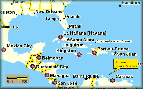
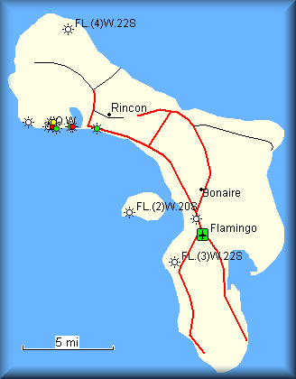
The island of Bonaire is located in the Caribbean Sea and is part of the Netherlands Antilles (Aruba, Bonaire, Curacao). It is located 50 miles north of Venezuela and 25 miles east of the island of Curacao. Bonaire is only 22 miles long from tip to tip and about 3-5 miles wide. There are roughly 15,000 permanent residents living on the island. Most of Bonaire is flat; the highest elevation is only 784 feet. There are over 80 dive sites with more than 355 species of fish around the island.
Despite its small size, nature
conservation is high on the agenda and more than 20% of the total land area
of Bonaire and 100% of the waters surrounding Bonaire and Klein Bonaire are
protected as Parks. The Washington Slagbaai National Park, which consists of
two former plantations, and covers a land area of 15,000 acres (6,000 ha)
was established in 1977. The Bonaire Marine Park which stretches from the
high water mark to the 200' (60m) depth contour all around Bonaire and Klein
Bonaire followed in 1979.

Bonaire Overview Map

Where is Bonaire?
Why dive Bonaire?
What is included?
What do I need to bring?
Marine Park Map Page
What will I see?
Image Gallery

Island Map